Roof Issues Commonly Missed From Ground Level
Context
Assessing roof condition often begins with a visual review from ground level or nearby vantage points. While this can provide an overview of roof form and materials, it rarely allows a complete understanding of condition, particularly on larger or more complex buildings.
In many commercial and residential settings, roof geometry, parapet walls, and changes in level mean that key areas are either partially visible or entirely concealed. This creates a risk that early-stage assessments rely on assumptions rather than direct observation.
Constraints of ground-level inspection
Ground-level observation is inherently constrained by viewing angle, distance, and obstructions. Even where binoculars or zoom photography are used, perspective distortion and limited lines of sight can prevent meaningful assessment of surface condition and detailing.
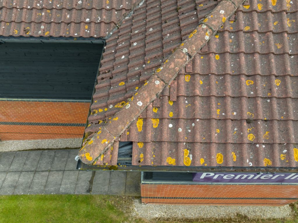
In addition, weathering, ponding, and minor defects often develop in areas that are set back from roof edges. These locations are rarely visible from street level and may only become apparent once issues have progressed.
Roof elements frequently concealed from view
The following elements are commonly difficult to assess without elevated access or aerial imagery:
Flat roof coverings located behind parapet walls
Internal gutters and valleys
Junctions between different roof types or levels
Lead flashings, upstands, and edge details
Rainwater outlets and hidden drainage paths
Coping stones and parapet wall construction
Areas screened by rooftop plant or services
Where these elements cannot be viewed directly, condition assessments are often incomplete or provisional.
Role of aerial imagery in visual assessment
Aerial imagery allows roof areas to be viewed from above and from oblique angles, providing a clearer understanding of layout and surface condition. This approach can be used to create a visual record of roof elements that are otherwise inaccessible without scaffolding or access equipment.
Imagery captured in this way provides a snapshot of roof condition at a specific point in time. It can be reviewed remotely, shared internally, and compared with previous inspections where records exist.
Types of observations typically supported by imagery
Depending on roof construction, age, and current condition, aerial imagery may assist in identifying:
Localised deterioration or damage to roof coverings
Displacement, cracking, or deterioration of coping stones
Accumulation of debris around outlets or within gutters
Standing water on flat roof areas at the time of survey
Degradation of flashings or junction details
Vegetation growth affecting drainage routes
These observations are visual in nature and should be interpreted within the limits of non-intrusive inspection.
Use within maintenance and planning processes
Visual roof imagery is commonly used during early planning stages to support maintenance discussions and refurbishment scoping. It can help identify areas that may require closer attention, prioritise future inspections, and inform decisions on whether physical access is necessary.
For portfolio managers and facilities teams, this approach can assist with consistency of assessment across multiple sites, particularly where immediate access is not practical.
Limitations of visual surveys
Aerial imagery does not confirm the condition of concealed elements, internal structures, or roof build-ups. It cannot replace intrusive inspection where this is required, and findings should always be considered alongside other sources of information.
Further investigation may be necessary where defects are suspected or where significant works are proposed.
Reference to survey methodology
For general information on the methodology used for visual roof surveys, see our main overview of drone roof survey services.