Drones have a variety of purposes, but one of their most popular applications is in mapping. Drone mapping offers many advantages over traditional methods, such as satellite imagery or ground surveying. In this blog post, we’ll take a closer look at what drone mapping is and how it can benefit your business. Stay tuned!
What is drone mapping and why is it becoming increasingly popular among businesses and individuals?
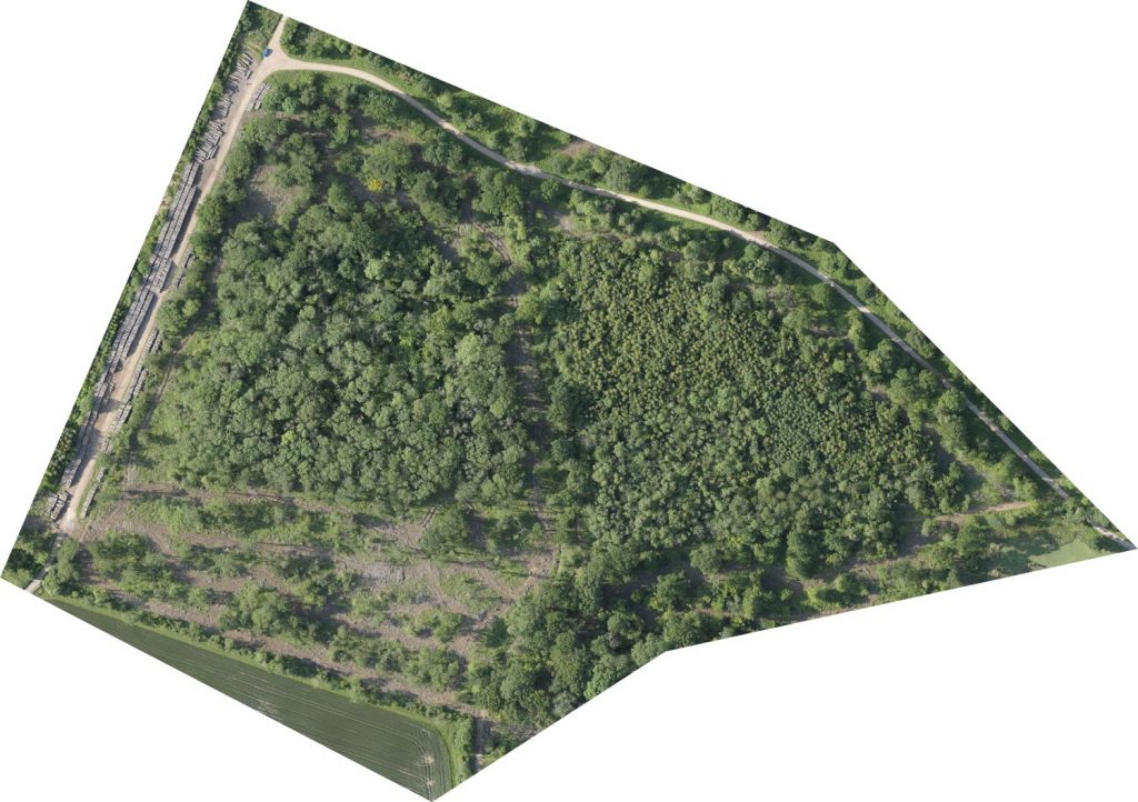
Drone mapping, or photogrammetry is the process of using drones to capture photos of an area, which are then stitched together to create a 2D or 3D map. This technology is often used for surveying land or inspecting structures, as it allows for a detailed and accurate view of the area in question. Drone mapping is becoming increasingly popular due to its many advantages over traditional methods such as ground-based surveys. For one, it is much faster and more efficient, as drones can cover large areas in a short period of time. Additionally, with drone mapping the images can be taken from multiple angles and at different heights. Finally, drone mapping can be safer than traditional methods, as it eliminates the need for workers to enter dangerous or difficult-to-reach areas.
How does drone mapping work, and what are the benefits of using this technology over traditional methods such as aerial photography or satellite imagery?
Drone mapping is a process of creating a 2D or 3D map using drone-mounted cameras and specialized software. The drone flies over the area to be mapped, taking photos at regular intervals. The photos are then stitched together using photogrammetry software to create a high-resolution map. Drone mapping offers several advantages over traditional methods such as satellite imagery and ground surveying. First, drone mapping can be done much more quickly and cheaply than using traditional ground surveying methods. Second, drone maps can be generated at very high resolutions, making them ideal for applications such as land surveying or agricultural monitoring. Finally, drone mapping can be used to create 3D maps, which can provide valuable insights into topography or terrain features.
How accurate is drone mapping?
Drone mapping is typically as accurate as traditional mapping methods, such as ground-based surveying. Excellent accuracy is achieved through the drone’s on-board GPS system which identifies each image location. Additional accuracy can be achieved using drones equipped with an RTK, or Real Time Kinematic system and survey-grade accuracy can be achieved by combining these systems with ground control points. Additionally, drone-mapping software has become more sophisticated in recent years, making it easier to produce high-quality maps and 3D models. As a result, drone mapping is becoming an increasingly popular tool for surveying and mapping applications.
What industries are benefiting from drone mapping the most, and how can you get started with this technology if you're interested in using it for your own business or projects?
Drone mapping is an invaluable tool for a variety of industries, from construction and engineering to agricultural and environmental conservation. By using drone mapping technologies like photogrammetry, businesses can save time and money while gaining a more accurate picture of their work site or project area. In addition, drone mapping can be used to create 3D models of terrain or buildings, providing a unique perspective that can be helpful for planning and design purposes. If you’re interested in using drone mapping for your own business or projects, there are a few things you’ll need to get started. First, you’ll need a drone that is equipped with high-quality cameras and sensors. You’ll also need to invest in software that can process the data collected by your drone and create detailed maps or 3D models.
If you want someone to look after the entire process for you, please contact us for a quote.
Are there any potential risks associated with drone mapping, and what safety precautions should be taken into account before getting started with this technology?
While drone mapping offers many benefits, there are also some potential risks that should be considered before getting started. One risk is from unlicensed, uninsured, or inexperienced operators who could cause damage to property or injury to people. To minimize this risk, it is important to employ a reputable drone company with a record of success.