Introduction
In the tapestry of technological evolution, the methods by which we survey and map our world have undergone remarkable transformations. From the rudimentary tools of ancient surveyors to the sophisticated satellite imaging of the modern age, each leap in technology has brought us closer to understanding the intricacies of our planet in finer detail.
Today, at the forefront of this ongoing revolution stands drone technology, promising to redefine the boundaries of data collection.
Gone are the days when ground-based surveying was the norm, often fraught with challenges and limitations.
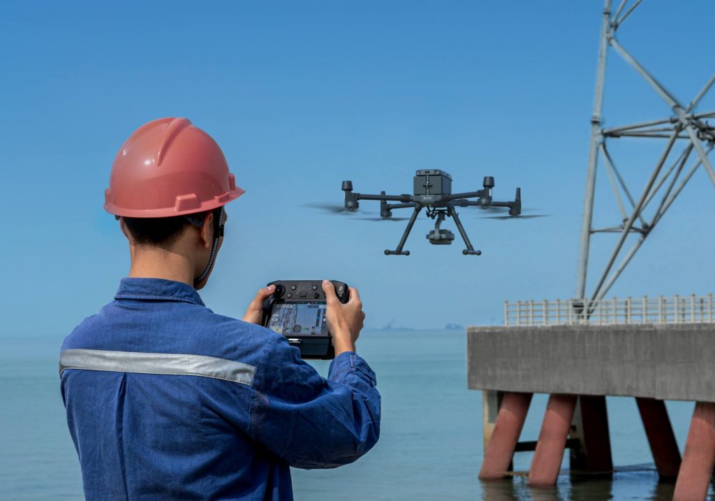
As we usher in an era of aerial surveys conducted by unmanned aerial vehicles (UAVs), or drones, we stand on the brink of a new paradigm in geospatial and built environment surveying and analysis.
This article aims to shed light on what drone surveys are, their mechanism of operation, and the myriad ways they empower industries by offering accuracy, efficiency, and accessibility in data collection.
What is a Drone Survey?
At its core, a drone survey is a method of collecting data from the air, utilising unmanned aerial vehicles (UAVs), or drones equipped with cutting-edge sensors.
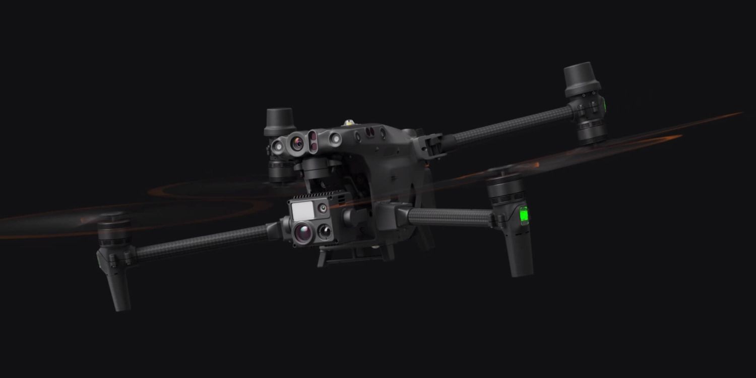
These sensors can range from high-resolution cameras capturing detailed images of the Earth’s surface or the built environment, to LiDAR systems that use laser light to measure distances and generate precise three-dimensional information about the shape and surface characteristics of the terrain.
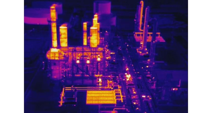
Additionally, drones may carry thermal sensors to detect heat variations, and GPS, RTK, or PPK devices to pinpoint exact locations with remarkable accuracy.
Drones used in surveys are typically categorised into two types: fixed-wing and rotary.
Fixed-wing drones resemble traditional aeroplanes and are prized for their ability to cover large distances efficiently, making them ideal for mapping expansive territories.
On the other hand, rotary drones, which include quadcopters and other multirotor configurations, offer greater maneuverability and the ability to hover, which is particularly useful for detailed inspections and projects requiring focused attention on specific areas.
What sets drone surveys apart from traditional methods is not just the technology they employ, but the perspective they offer.
Flying at lower altitudes than manned aircraft or satellites, drones capture data from vantage points that were previously inaccessible or prohibitively expensive to reach.
This capability opens up a new world of possibilities for mapping, inspecting, and monitoring land and structures with an unparalleled level of detail and precision.
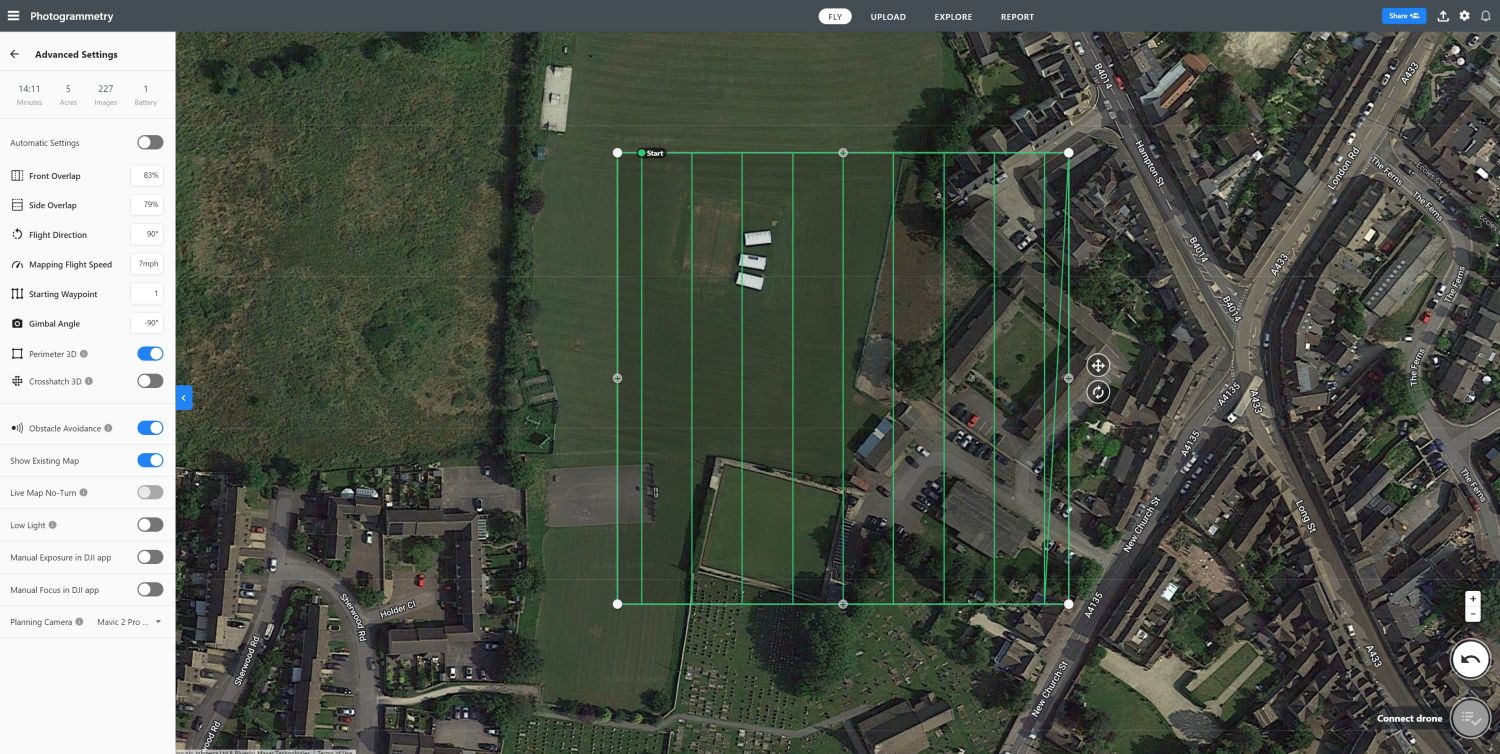
The process of conducting a drone survey involves several steps, starting with careful planning to define the survey area and the specific data requirements.
Flight paths are meticulously plotted to ensure comprehensive coverage, taking into account factors such as the drone’s battery life, sensor capabilities, and legal or environmental constraints.
Once in the air, drones can autonomously navigate these predefined routes, capturing data that is later processed using specialised software. Although building and asset inspection is often carried out using autonomous flight paths, drone operators frequently choose to fly these manually in order to ensure they capture the intricate details necessary for a successful building or infrastructure survey.
The post-processing stage is crucial, as it transforms raw imagery and sensor readings into actionable insights, whether it be detailed maps, 3D models, or other forms of analytical outputs, such as a drone roof survey report.
In essence, drone surveys represent the convergence of robotics, aviation, geospatial science, and knowledge of the built environment offering a potent tool for a multitude of applications.
From agriculture and construction to environmental conservation and urban planning, the insights garnered from drone surveys are helping industries and researchers alike to make informed decisions, optimise operations, and understand our world with a clarity never before possible.
How Does a Drone Survey Work?
The process of conducting a drone survey is a blend of technical precision, meticulous planning, and advanced processing techniques.
It transforms the simple act of flying a drone into a sophisticated method of collecting high-quality geospatial data. Here’s a closer look at the steps involved in making a drone survey work effectively:
Planning and Preparation
The initial phase of a drone survey involves detailed planning to ensure the success of the mission. This includes selecting the right type of drone and sensors based on the specific requirements of the survey, such as the size of the area to be surveyed, the desired resolution of the data, and any particular environmental considerations.
Surveyors then proceed to map out the flight path. This is a critical step where the drone’s trajectory is carefully designed to cover the entire survey area efficiently while ensuring optimal data collection.
Factors like the drone’s battery life, the altitude at which it will fly, and the overlap needed between images for stitching, or the detail required are all taken into account.
Legal considerations, such as avoiding restricted airspace and ensuring privacy compliance, are also addressed during this stage.
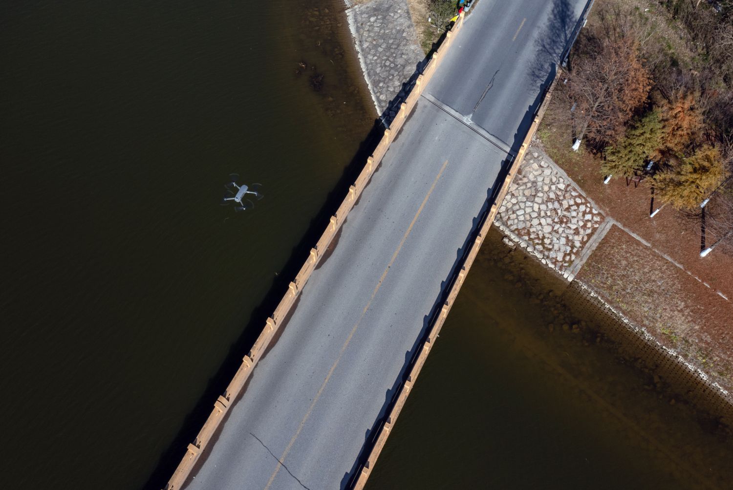
Flight Execution
With the planning complete, the drone is launched to either autonomously navigate the predefined route or be manually flown in the case of many asset and building surveys.
Modern drones are equipped with GPS and sophisticated flight control systems, allowing them to follow planned flight paths with high precision and fly with great stability during manual flight.
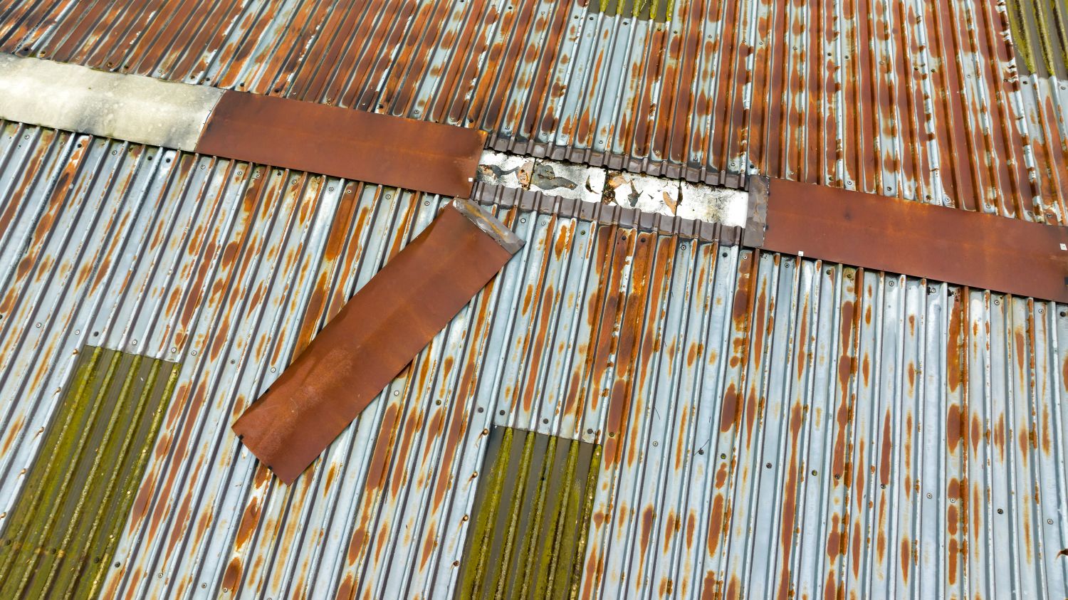
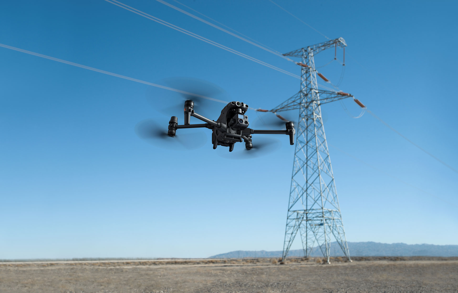
During the flight, the drone’s sensors collect data across the survey area. This can range from capturing a series of overlapping photographs for photogrammetry, detailed images for roof and asset surveys, to recording LiDAR data for 3D mapping, or thermal imaging for environmental monitoring and inspections.
Data Collection
As the drone flies, it continuously collects data according to its equipped sensors. High-resolution cameras capture detailed images of the ground, LiDAR sensors generate precise topographical maps by measuring the time it takes for emitted light to return to the sensor, and other specialised sensors can gather additional types of data, such as thermal or multispectral imagery. This data is either stored onboard the drone or transmitted in real-time to a ground station.
Post-Processing and Analysis
After the drone has landed, the real magic begins in the form of data processing.
This stage transforms the raw data collected by the drone into usable information.
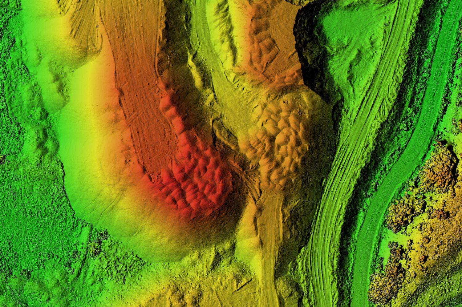
Images are stitched together to create detailed orthomosaics or 3D models of the surveyed area. LiDAR data is processed to generate digital elevation models (DEMs) or other 3D representations. Advanced software algorithms analyse the data to extract meaningful insights, such as volume calculations, change detection over time, or identification of specific features within the imagery. Images are enhanced to bring out shadow detail in the case of roof and building inspections.
Delivering Actionable Insights
The final step involves translating the processed data into actionable insights for the client or project team.
This might involve creating detailed reports, interactive maps, or digital twins of the surveyed area.
These outputs can be used for a wide range of applications, from planning construction projects and monitoring agricultural land to inspecting roofs and buildings for damage, and urban planning.
The effectiveness of a drone survey is not just in the flight or the technology used, but in the integration of planning, execution, and analysis to provide detailed, accurate, and timely data.
This process, when executed well, can offer insights into the physical world with a speed, accuracy, and detail that traditional surveying methods cannot match, revolutionising how we collect and use survey data and geospatial information.
Benefits of Drone Surveys
Drone surveys bring a host of advantages over traditional survey methods, revolutionising how data is collected and analysed across various industries.
These benefits include:
Accuracy and Resolution: Drones equipped with high-resolution cameras and precise sensors can capture detailed images which can be translated into precise measurements of the Earth’s surface, offering superior data quality and accuracy.
Efficiency and Time-Saving: Drones can cover large areas much faster than ground-based survey methods, or the use of access equipment, significantly reducing the time required for data collection and allowing for more frequent updates.
Cost-Effectiveness: By reducing the need for manual labour and the time it takes to survey large or difficult-to-access areas, drones can offer substantial cost savings over traditional methods.
Accessibility and Safety: Drones can easily reach and collect data from areas that are hazardous or inaccessible to humans, reducing the risk of accidents and ensuring the safety of survey teams.
Environmental Monitoring: With the ability to monitor changes over time, drones are an invaluable tool for environmental conservation efforts, including tracking deforestation, wildlife populations, and the effects of climate change.
Applications of Drone Surveys
The versatility of drone surveys makes them applicable in a wide array of fields, including:
Agriculture: Farmers use drone surveys for precision agriculture practices, such as monitoring crop health, optimising irrigation, and managing pests and diseases.
Construction and Property: In the construction industry, drones monitor site progress, assist in planning, and help in the maintenance of structures. Property professionals use drone imagery for marketing properties, while surveyors use drone imagery to compile condition reports.
Mining: Drones provide a safe and efficient way to map and manage mining operations, from exploration and planning to monitoring environmental compliance and rehabilitation efforts.
Environmental Science and Conservation: Researchers and conservationists use drones to study ecosystems, track wildlife, and monitor changes in the environment without disturbing the natural habitat.
Urban Planning and Infrastructure: Local governments and urban planners utilise drones for mapping, inspecting infrastructure, and planning urban development with up-to-date geospatial data.
Challenges and Considerations
Despite their benefits, drone surveys come with challenges and considerations that need to be addressed:
Regulatory Compliance: Drones must operate within legal frameworks that vary by country and region, including restrictions on airspace, privacy laws, and data protection regulations.
Weather Dependence: Drone operations can be affected by adverse weather conditions, such as strong winds, rain, or fog, which can limit their availability and the quality of data collected.
Data Security and Privacy: The collection and handling of data, especially in populated areas, raise concerns about privacy and data protection, requiring careful management and adherence to legal standards.
Technical Limitations: While advancing rapidly, drone technology and the capacity to process large volumes of data still have limitations, necessitating ongoing development and investment.
Conclusion
Drone surveys represent a significant leap forward in our ability to gather and analyse geospatial data. By offering a combination of high accuracy, efficiency, and versatility, they have become an indispensable tool in numerous industries.
From rapidly inspecting buildings and infrastructure to enhancing agricultural productivity, and facilitating urban planning and environmental conservation, the applications of drone surveys are vast and continually expanding.
However, the successful integration of drone technology into surveying practices requires careful consideration of regulatory, ethical, and technical challenges.
As the technology evolves and becomes more integrated into mainstream use, addressing these challenges will be crucial for unlocking the full potential of drone surveys.
In conclusion, the advent of drone surveys is more than just a technological novelty; it’s a paradigm shift in how we collect, analyse, and utilise data.
By embracing this technology, industries and societies can gain insights into the physical world with unprecedented clarity and speed, opening new avenues for innovation, conservation, and development.
The future of drone surveys is not just about flying higher, but about seeing our world in new and transformative ways.
If you’re looking for a capable, experienced, and professional company to carry out your drone survey, get in touch now.